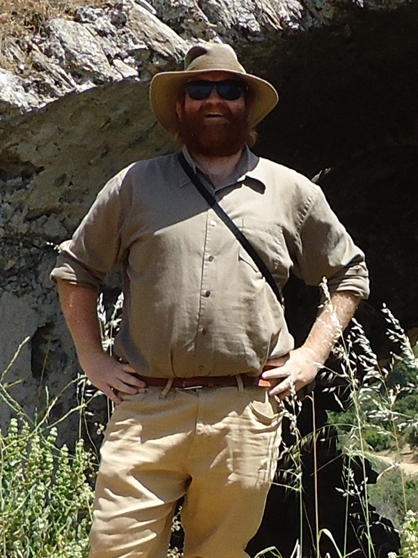
Jon Tyler Wolford is a Byzantine archaeologist and PhD candidate in the Medieval Studies program at Cornell University. His current dissertation project seeks to understand how and why people came to live in permanent settlements on the mountains of Latros and Mykale in the middle Byzantine period. Usually, increased habitation in mountains is explained by political and military instability. However, the association of flight from war to mountainous habitation obscures a complicated and often contradictory relationship between mountains and war.
During his tenure at ANAMED, Tyler intends to research the relationship between middle Byzantine institutions which thrived in this period, such as newly founded mountain monasteries and the encroaching imperial estates in the valley below, and the settlements in the mountains.
The 2023–2024 ANAMED doctoral fellowship allowed me to finish my dissertation: “Mountain Resilience: Settlement on Mount Latros and Mykale in Middle Byzantine Western Asia Minor.” The fellowship provided the time, space, and atmosphere to write, a thriving community of scholars with whom to engage on questions of my work, and the opportunity to travel, both to visit sites within my dissertation and beyond.
My dissertation sought to understand the resilience of the middle Byzantine settlement on the mountains of Mykale and Latros (classical Latmos) in Western Asia Minor on either side of the Maeander River Valley. Living on mountain landscapes requires resilience due to unique challenges, such as isolation, difficult water management on slopes, lack of space for cultivation, and limited access to subsistence. Archaeological surveys conducted on each mountain show an increase of settlement in the middle Byzantine period.[1] Why did settlement on the mountain increase in the middle Byzantine period? I approached this question through the lens of resilience theory and methodologies rooted in mapping the landscape. Resilience theory provides a framework to understand permanent settlement, instead of short-term uses of the mountain. I developed a novel method for mapping the border descriptions of the 1073 Byzantine survey document known as the Praktikon of Adam.[2] When the results of this mapping technique are compared with the archaeological survey data, the settlement patterns of the mountain and the wider Maeander region come into clearer focus. Usually, Byzantine mountain settlement is explained by reference to regional insecurity. The usual association obscures a complicated and often contradictory relationship between mountains and war. I argue that the resilience of upland habitation is rooted in the interconnection of two codependent institutions of the tenth and eleventh centuries: the newly founded mountain monasteries of Stylos and Hiera Xerochoraphion and the imperial estates. When these monasteries were founded, the mountains were no longer marginal territory. The leaders of these monasteries reorganized and founded new mountain routes to ship in supplies to monastic communities that could not feed themselves from their immediate hinterlands. Still, these monasteries were only able to inhabit and thrive in the mountains as an extension of the demographic and economic recovery in the wider Maeander Valley. The imperial estates in the Maeander Valley and their aggressive administrators encroached upon the episcopal lands of cities like Amyzon, Herakleia, Miletus, Priene, and Anaia. By undermining the ability of the bishop to assert authority over the mountains, these imperial estates contributed to a mountain settlement pattern organized around monastic interests.
Due to the generosity of the ANAMED fellowship, I had the time to finish writing my dissertation. I rewrote a chapter dedicated to the role played by cities and their bishops in the increased settlement on the mountains. Far from being a driver of this settlement increase, the authority of the cities of the Maeander Valley (especially their bishops) was challenged in the tenth and eleventh centuries by monastic founders building monasteries just outside of episcopal oversight and imperial estate administrators who actively encroached upon episcopal land. Due to access to materials at the ANAMED library (and those materials brought in from Koç University’s main campus and its AKMED branch in Antalya), I was able to update the chapter and bring it into alignment with my wider argument and compose the introduction and conclusion of my dissertation.
The community of scholars at ANAMED during the 2023–2024 year was an incredible resource for refining the ideas within my research. While the formal Wednesday tea presentations were the most visible venue for feedback on our projects, the daily discussions with colleagues, such as while drinking coffee on the terrace, were the most prevalent. Of particular note were two working groups, organized by ANAMED fellows around specific topics: the Byzantine Studies working group and the GIS (Geographic Information System) working group. In the Byzantine Studies working group, I delivered two informal presentations on aspects of my dissertation and received invaluable feedback from my colleagues. The first presentation, “Pirates on the Mountain!” explored the role that patterns of warfare could have had on Mount Latros and Mykale, especially the cyclical use of the transhumant routes of shepherds to and from the mountains. In the second presentation, “The Imperial Estates of the Maeander Valley,” I refined my methodology for mapping the border descriptions within the Praktikon of Adam. The members of this group also organized trips around Istanbul, such as to the Fener district, along the Theodosian Walls, and to the region of the Great Palace of Constantinople. The trip to Mardin, about which I will elaborate below, was also done with this group of scholars. I organized the GIS working group to bring together ANAMED fellows with both experience and interest in utilizing mapping software for research. While I could go into more detail here, I have written about the GIS working group in my ANAMED blog entry: [LINK].
A highlight of being an ANAMED fellow is the opportunity to travel throughout Türkiye to visit archaeological sites. On route to ANAMED (i.e. September 2023), I travelled to Mount Latros (modern Beşparmak Dağ) and explored a side of the mountain, which my research had begun to signal was important. I had visited the region in the spring of 2022, but I did not yet understand then which aspects of the topography of the mountains would prove vital to my research. The experience of hiking the mountain trails provided incredible insights that maps often cannot. This second trip to the mountain, made possible by the ANAMED fellowship could be more targeted in its approach. In this trip, I focused on the northern slopes of Mount Latros, which were the sphere of influence of the tenth century monastery of Stylos (Fig. 1). Not only does the monastery have a visual connection with these slopes (and not the southern slopes facing Lake Bafa), but the mountain streams flowed from the area around the monastery through a village on the plateau below. A story about finding the spring near Stylos in the Life of Saint Paul the Younger reveals the importance of the spring in the relationship between the monastery and its mountain neighbors.[3] Natural topography likely had a role in defining some aspects of the relationship between this monastery and a Byzantine village in the region of modern Köprüalan.[4]
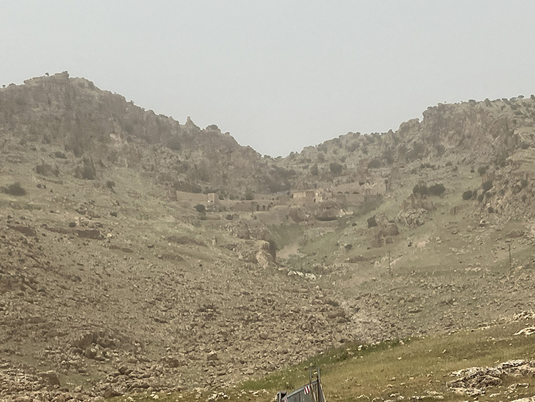
As part of the ANAMED Byzantine Studies working group, mentioned above, a trip to the region around Mardin, Şanlıurfa, and Diyarbakır was planned and undertaken at the end of April 2024. The region, also known as Tur Abdin, is the study area for some of our colleagues at ANAMED during the 2023–2024 year. The region provided an interesting comparanda to the mountains of my project. I gained new insights by considering the earlier monasteries of the Tur Abdin, such as Mor Augin on Mount Izla, Mor Gabriel, and Mor Hananyo, vis-à-vis the later monasteries on Mount Latros and Mykale. Mor Augin, built higher up on the mountain (Fig. 2), was an interesting comparison to the monastery of Stylos high up on Mount Latros. The built environments of both monasteries show the diverse ways that monastic builders could engage with the limitations imposed by the rugged mountain landscape. The larger monasteries of Mor Gabriel and Mor Hananyo (Dayr al-Zafaran) were instead embedded within their agricultural lands. In addition to the monastic sites, I gained a wider perspective on the art of fortification by visiting the fortresses and city walls of Harran, Dara, Diyarbakır, and Şanlıurfa.
In conclusion, my time at ANAMED has been very productive. I finished writing my dissertation with the time, space, and resources provided by an ANAMED research fellowship. The community of scholars at ANAMED provided critical insights and critiques on my work. The institute’s location within the city of Istanbul was great not only for local travel and visits throughout the city, but also as a launch point for wider research travel throughout Türkiye.
[1] Hans Lohmann, Georg Kalaitzoglou, and Gundula Lüdorf, Survey in der Mykale (Dilet Daglan / Aydin) 2001–2009: Landeskunde eines westleinasiatischen Gebirgszuges vom Chalkolithikum bis in spätosmanische Zeit, Forschungen in der Mykale I, Parts 1 and 2 (Bonn: Rudolf Habelt, 2014–2017), 278–79.
[2] Maria Nystazopoulou-Pelekidou, ed., Βυζαντινὰ ἔγγραφα τῆς Μονῆς Πάτμου, Volume 2, Δημοσίων λειτουργῶν (Athens: National Institute of Research, 1980), 3–35.
[3] Hippolyte Delehaye, ed. “Vita S. Pauli Iunioris in Monte Latro cum interpretatione latina Iacobi Sirmondi S. J.” AB 11 (1892): 49–50.
[4] Volker Höhfeld, “Kulturlandschaftswandel im Latmos (Beşparmakö Südwest-Türkei). Ein Beitrag zur genetischen Siedlungsforschung in einem Bergland Westantoliens,” in Feldforschungen im Latmos. Forschungen im Umland von Herakleia am Latmos, ed. Hans Lohmann (Bonn: Hablet-Verlag, 2019), 18–22, 48.
 Fig. 1. A View of the Northern Slopes of Mount Latros from the Monastery of Stylos (Photo by author).

Fig. 2. A View of the Monastery of Mor Augin in Mount Izla in the Tur Abdin (Photo by author).

